


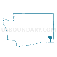
Scoggin Voting District, Garfield County, Washington
About
Outline

Summary
| Unique Area Identifier | 684273 |
| Name | Scoggin Voting District |
| County | Garfield County |
| State | Washington |
| Area (square miles) | 103.11 |
| Land Area (square miles) | 103.11 |
| Water Area (square miles) | 0.00 |
| % of Land Area | 100.00 |
| % of Water Area | 0.00 |
| Latitude of the Internal Point | 46.37969780 |
| Longtitude of the Internal Point | -117.59913310 |
Maps


Graphs
Select a template below for downloading or customizing gragh for Scoggin Voting District, Garfield County, Washington


Neighbors
Neighoring Voting District (by Name) Neighboring Voting District on the Map
- Mayview Voting District, Garfield County, WA
- Pataha Voting District, Garfield County, WA
- Peola Voting District, Garfield County, WA
- Ping Voting District, Garfield County, WA
- Pomeroy Ward 1, Garfield County, WA
- Pomeroy Ward 2, Garfield County, WA
- Pomeroy Ward 3, Garfield County, WA
- Pomeroy Ward 4, Garfield County, WA
- Tucannon Voting District, Garfield County, WA
- Tucannon Voting District, Columbia County, WA
- Umatilla National Forest, Columbia County, WA
Top 10 Neighboring County Subdivision (by Population) Neighboring County Subdivision on the Map
- Dayton CCD, Columbia County, WA (3,620)
- Pomeroy CCD, Garfield County, WA (1,875)
- Snake River CCD, Garfield County, WA (391)